...
 Cornell Geospatial Forum
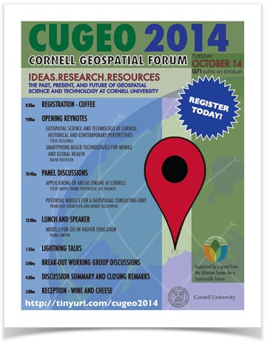
Tuesday, October 14, 2014
Martha Van
...
Rensselaer Hall G71
Spatial analyses and place-based studies are more important than ever in the world today, and the digital technologies that support such work are becoming much more commonplace and in high demand. At Cornell we are at a turning point, as we face increasing demands and opportunities for support of geospatial research, teaching, and extension, while at the same time lacking a clear vision for how such demands will be met, especially as several key players from within our geospatial community transition out through retirement.
...
For more detailed background on this effort, please see our pre-event briefing paper, Sustaining Geospatial Science and Technology at Cornell University.
Due to overwhelming interest, we are asking that people register for this event by October 6. Register now to guarantee your seat (and a lunch).

If you would like to present a lightning talk, submit your lightning talk proposal by October 6.
And whether or not you can attend, we also invite you to respond to our Working Group Discussion questions, which will form the basis for communicating the outcomes of this event to the Cornell Community.
, which will be updated based on discussions and feedback from CUGEO.
Schedule
| 8:30am | Registration - Coffee | ||
| 9:00am | Opening KeynotesRemarks
| ||
| 9:10am | Opening Keynote: Geospatial Science and Technology at Cornell: Historical and Contemporary Perspectives
| ||
| 9:40am | Cornell NutriPhone Demo and Keynote: Smartphone-based Technologies for Mobile and | Nano TechnologiesGlobal Health
| |
| 10:20am | Coffee break | ||
| 10:40am | Panel Discussions1: Applications of ArcGIS Online at Cornell | ||
| 11:30am | Panel 2: Potential Models for a Geospatial Consulting Unit | ||
| 12:00pm | Lunch | and Speaker||
| 12:30pm | Models | of for GIS in Higher Education | in the U.S.
|
| 1:10pm | Break | ||
| 1: | 15pm20pm | Lightning Talks (5- | minute and 2-minute talks)minutes or less)
|
| 2:40pm | Coffee Break | ||
| 3:00pm | Break-out Working Group Discussions | ||
| 4:30pm | Discussion summary and closing remarks | ||
| 5:00pm | Reception - Wine and Cheese |
Who should attend?
Anyone who...
- uses GIS software such as ArcGIS, Manifold, or QGIS
- does spatial analysis using other statistical or programming tools (R, SPSS, Python, etc.)
- thinks about spatial aspects of their research
- makes maps or needs someone else to make maps
- is interested in learning more about GIS at Cornell
Who is organizing this effort?
- Steve DeGloria (Professor, Crop and Soil Sciences; Director, Institute for Resource Information Sciences)
- Julia Finkelstein (Assistant Professor of Epidemiology and Nutrition; Fellow, Center for Geographic Analysis at Harvard University)
- Joe Francis (Associate Professor, Development Sociology; Director, Program in Applied Demography)
- Keith Jenkins (GIS/Geospatial Applications Librarian, Mann Library)
- Boris Michev (Map and Geospatial Information Librarian, Olin Library)
- Diana Sinton (Associate Adjunct Professor, Crop and Soil Sciences)
- Sarah Young (Health Science and Policy Librarian, Mann Library)
Who is funding this event?
The Cornell Geospatial Forum is supported by a grant from the Atkinson Center for a Sustainable Future.


| HTML |
|---|
<script>
// Automatically collapse sidebar
$(document).ready(function() {
  var zzz = $('.expand-collapse-trigger').first();
  if (zzz.data('tooltip').match(/collapse/i)) {
    zzz.click();
  }
});
</script> |